Home > Electronics & Navigation > Navigation > Charts (Electronic)
Manufacturer #: 010-C1334-30
Card Type: SD/MSD
We're currently unable to show live stock information on our website, so if you need delivery fast we strongly recommend checking availability first. Simply fill out the form below and we'll get back to you, or call us on +44 (0)1243 375774 for an immediate answer.
Be the first to Write a Review for this item!
Navionics+ cartography provides integrated offshore and inland marine mapping content with rivers, bays and more than 42,000 lakes around the world. This all-in-one solution offers clear, reliable cartography for the widest range of chartplotter brands.
The Navionics Subscription
A one-year subscription to Daily Updates and advanced features is included when you purchase any Navionics+ mapping solution. After a year, you can renew at a discounted price.
Charts & Updates
Advanced Features
Coverage Areas
Worldwide map coverage is available, with integrated content making it easier to select the navigation features and map regions you want. Choose from large coverage areas (Large) to more localized chart cuts (Regular).
Compatibility
Check compatibility of Navionics+ content and features with your GPS chartplotter.
1Subscription required.
2Dock-to-dock Route Guidance is for planning purposes only and does not replace safe navigation operations.
3Subscription not required for SonarChart Live mapping feature on some chartplotter models; requires latest chartplotter firmware release. NOTE: Navionics+ and Platinum+ cards are not compatible with Garmin chartplotters.
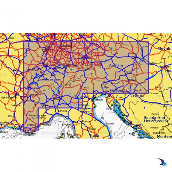
Navionics - Navionics+ NAEU066R Alpine, Lakes & Rivers
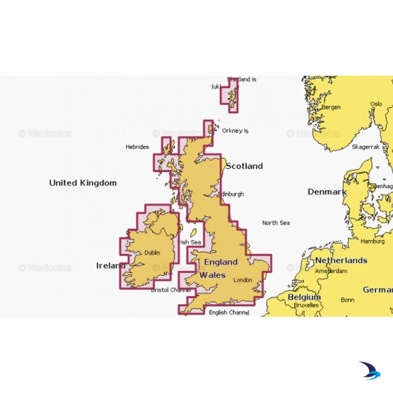
Navionics - Navionics+ NAEU072R U.K. & Ireland Lakes & Rivers
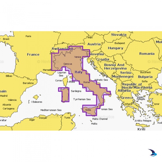
Navionics - Navionics+ NAEU073R Italy, Lakes & Rivers
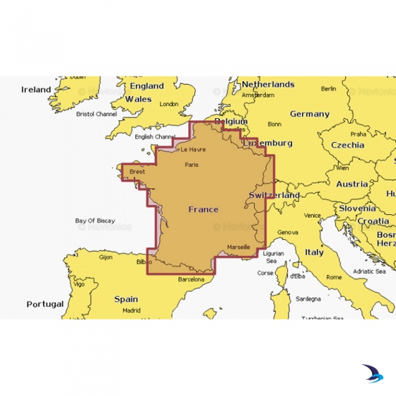
Navionics - Navionics+ NAEU080R France, Lakes & Rivers
My Account Total: £0.00